-
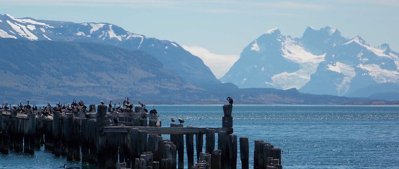 Chilean Fjords, Chile © Angel Diaz Cofré/Wikipedia/CC BY-SA 3.0
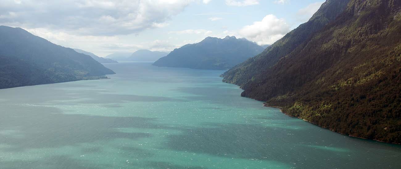 Chilean Fjords, Chile © Sam Beebe/Wikipedia/CC BY-SA 2.0
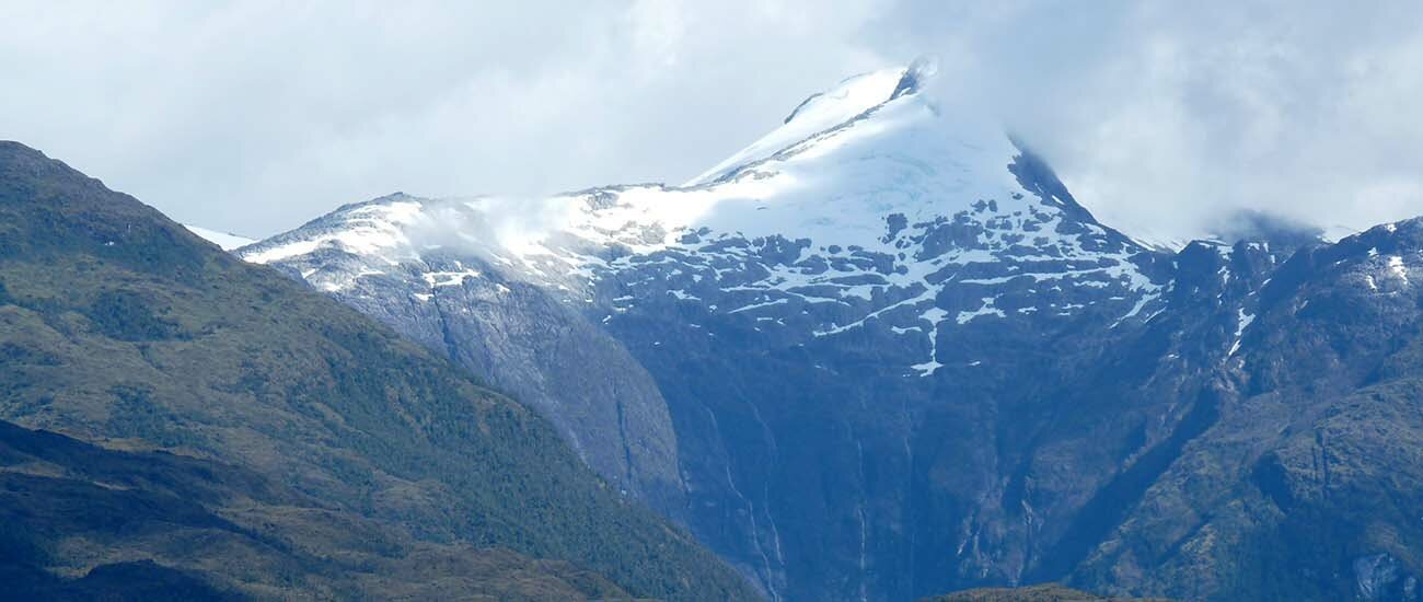 Chilean Fjords, Chile
Chilean Fjords, Chile
The southern coast of Chile presents a large number of fjords and fjord-like channels from the latitudes of Cape Horn (55° S) to Reloncaví Estuary (42° S). Some fjords and channels are important navigable channels providing access to ports like Punta Arenas, Puerto Chacabuco, and Puerto Natales.
History
During colonial times, the fjords and channels of Patagonia were first explored by the Spaniards motivated by: a) their attempts to Christianize indigenous peoples; b) to prevent and evict any potential foreign power intrusion into territory claimed by Spain; c) to increase the geographic knowledge on the zone; and d) for the search of a mythical city called City of the Caesars. In 1792, the viceroy of Peru ordered the exploration of the Patagonian channels in order to find an entrance to the interior of Patagonia. The said order was carried off by José... Read more
Destination:Chilean Fjords, ChileThe southern coast of Chile presents a large number of fjords and fjord-like channels from the latitudes of Cape Horn (55° S) to Reloncaví Estuary (42° S). Some fjords and channels are important navigable channels providing access to ports like Punta Arenas, Puerto Chacabuco, and Puerto Natales.
History
During colonial times, the fjords and channels of Patagonia were first explored by the Spaniards motivated by: a) their attempts to Christianize indigenous peoples; b) to prevent and evict any potential foreign power intrusion into territory claimed by Spain; c) to increase the geographic knowledge on the zone; and d) for the search of a mythical city called City of the Caesars. In 1792, the viceroy of Peru ordered the exploration of the Patagonian channels in order to find an entrance to the interior of Patagonia. The said order was carried off by José de Moraleda who led an expedition that visited many of the main channels of the zone. In the early to the mid 19th century, explorations by hydrographers like Robert FitzRoy and Francisco Hudson increased knowledge on the channels. The channels south of the Isthmus of Ofqui were explored in detail by Chilean government agent Hans Steffen in the late 19th century.
Climate and geography
This route is mostly used by vessels desiring to avoid the heavy seas and bad weather so often experienced on passing into the Pacific Ocean from the western end of the Strait of Magellan. The large full-powered mail steamers generally at once gain the open sea at Cape Pillar (at the west entrance of the Strait of Magellan), as experience has shown that time is thus saved to them; but vessels of less engine power, to which punctuality and dispatch is not so much an object as avoiding possible danger, will find the Patagonian Channels the best route.
The general features of these channels are high, abrupt shores, with innumerable peaks and headlands remarkably alike in character, their bold, rugged heads giving an appearance of gloomy grandeur rarely seen elsewhere. The shores are generally steep-to and the channels, for the most part, open and free, while the few dangers that exist are usually marked by kelp. The tides are regular and not strong, except in the English Narrows.
In the case of the two above mentioned and some other fjords, these waterways proved of value as transport lanes when western Patagonia was settled and incorporated into Chile. On the other hand, the fjords have served as a natural barrier preventing north-south land travel in Chilean Patagonia.
Legal status of the waterways
All waters between the Chilean baselines and the continental shoreline are internal waters, according to the Chilean decree 416 of 14 June 1977 based in the United Nations Convention on the Law of the Sea, that is, the coastal nation is free to set laws, regulate any use, and use any resource. Foreign vessels have no right of passage within internal waters, and this lack of right to innocent passage is the key difference between internal waters and territorial waters. Chile allows the use of the main waterways under maritime authority dispositions for the following navigation lanes (all names in Spanish):
a) throughout the Strait of Magellan:
Punta Dúngenes - Primera Angostura - Segunda Angostura, Paso Nuevo -Paso Inglés - Paso Tortuoso - Paso Largo - Paso del Mar - Cabo Pilar (and back).
b) from Cabo Tamar to Isla San Pedro :
Cabo Tamar - Canal Smyth - Canal Mayne or Canal Gray - Paso Victoria - Estrecho Collingwood - Paso Farquhar - Canal Sarmiento - Angostura Guías - Canal Inocentes - Canal Concepción - Paso Caffin - Canal Trinidad - either Pacific Ocean, (and back) or to continue Canal Wide - either (east route) Canal Icy - Canal Grappler or (west route) Canal Escape - Paso del Abismo or Paso Piloto Pardo - Canal Escape; then Paso del Indio - Angostura Inglesa - Canal Messier to Isla San Pedro, (and back) or from Cabo Ladrillero to Canal Concepción to inner channels (and back)
c) From Strait of Magellan to Puerto Natales or Puerto Bories:
from Isla Brinkley - Seno Unión - Canal Morla Vicuña - Canal y angostura Kirke - Canal Valdés, Golfo Almirante Montt - Canal Señoret - Seno Última Esperanza - Puerto Natales - Puerto Bories (and back)
d) from Strait of Magellan to Puerto Williams:
from islote Anxious - Canal Magdalena - Canal Cockburn - Paso Brecknock or Canal Ocasión - Canal Unión - Paso Occidental - Paso Norte - Canal Ballenero- Canal O'Brien - Paso Timbales - Brazo noroeste del Canal Beagle - Canal Beagle - Puerto Williams (and back).(Chilean ships can use Paso Aguirre)
e) from Puerto Williams to Cabo de Hornos:
Canal Beagle - Paso Picton - Paso Richmond - to Cabo de Hornos (and back)
f) to the east Beagle Channel:
Ships coming from the east can access through the eastern mouth, northeast of Isla Nueva or through the Pasos Richmond and Picton.
g) to Seno Otway and Seno Skyring:
from Isla Carlos III - Canal Jerónimo - Seno Otway - Canal Fitz-Roy - Seno Skyring to Bahía Mina Elena (and back).
h) to Isla Guarello:
from Isla Inocentes - Canal Concepción - Canal Oeste - Seno Contreras - Bahía Corbeta Papudo in Isla Guarello, (and back), or from Bahía Corbeta Papudo in Isla Guarello - Seno Contreras - Paso Metalero (and back).
i) throughout Chonos Archipelago:
- from isla Inchemó - Bahía Anna Pink - Boca Wickham - Canal Pulluche - Canal Chacabuco - Canal Errázuriz - Canal Moraleda until Gulf of Corcovado and Boca del Guafo (and back) or
- from isla Inchemó - Bahía Anna Pink - Boca Wickham - Canal Pulluche - Canal Utarupa - Canal Darwin -Canal Moraleda to Gulf of Corcovado and Boca del Guafo (and back) or
- from isla Auchilú, - Bahía Darwin - Canal Darwin - Canal Moraleda to Gulf of Corcovado and Boca del Guafo (and back) or
- from Bahía Adventure - Isla Liebre - Canal Niñualac - Canal Moraleda to Gulf of Corcovado and Boca del Guafo (and back).
j) to bahía Chacabuco:
from Canal Moraleda - Paso del Medio or Canal Pilcomayo or Canal Ferronave - Seno Aysén to Bahía Chacabuco (and back).
k) to Laguna San Rafael:
- from Canal Moraleda - Paso Casma - Canal Costa - Estero Elefante - Paso Quesahuén - Golfo Elefantes and Río Témpanos - Laguna San Rafael (and back) or
- from Canal Moraleda - Canal Errázuriz - Paso Tres Cruces - Estero Elefantes - Paso Quesahuén - Golfo Elefantes and Río Témpanos - Laguna San Rafael (and back).
l) through the inner channels of Chiloé:
from Boca del Guafo or Golfo Corcovado to Puerto Montt or to Golfo de Coronados, (and back) throughout the inner Channels heading to ports and bays
m) to Puerto Montt through Canal de Chacao:
from golfo Coronados - Canal de Chacao - Golfo de Ancud - Canal Calbuco or Paso Queullín - Seno de Reloncaví - Paso Guar - Puerto Montt (and back).
Source:https://en.wikipedia.org/wiki/Fjords_and_channels_of_Chile
Text is available under Creative Commons Attribution-ShareAlike 3.0LOCAL TIME
4:34 amMay 29, 2022CURRENT WEATHER

5.67 °C / 42.206 °F
broken cloudsMon

5.49 °C/42 °F
few cloudsTue

5.47 °C/42 °F
sky is clearWed
6.4 °C/44 °F
sky is clearThu

7.05 °C/45 °F
light rainLOCAL CURRENCY
CLPTravelers recommend visiting the following places of interests

Eyre Fjord, Chilean Fjords, Chile
Eyre Fjord is a fjord in Chile. It extends for 20 miles north from its mouth to its terminus at Pío XI Glacier, and is located at 49°20′S 74°07′W. The fjord has two side fjords on its eastern side called Falcon and Exmouth. The mountains surrounding the fjord reach 1,300 m (4,300 ft).Comau Fjord, Chilean Fjords, Chile
Comau Fjord, also known as Leptepu Fjord, is a fjord that penetrates the mainland of Chile, in Los Lagos Region. It runs in a generally north-south direction from the Gulf of Ancud and is 68 km long. The fjord receives the waters of the Vodudahue River.Cape Horn, Chilean Fjords, Chile
Cape Horn (Dutch: Kaap Hoorn , Spanish: Cabo de Hornos), named after the city of Hoorn in the Netherlands, is the southernmost headland of the Tierra del Fuego archipelago of southern Chile, and is located on the small Hornos Island. Although not the most southerly point of South America (which are the Diego Ramírez Islands),...Mitchell Fjord, Chilean Fjords, Chile
Mitchell Fjord is an 30 to 50–km long fjord in Chile, stretching southeast from the vicinities of Baker Channel into the valley of Bravo River. Through a ferry based on Puerto Yungay, the channel provides access to the southernmost portion of Carretera Austral and constitutes thus the only discontinuous section of Carretera Austral south of...Peel Fjord, Chilean Fjords, Chile
Peel Fjord is a fjord in Chile. It branches off from the Sarmiento Channel and is located at 50°52′S 74°0′W. The east side of the fjord has three side fjords, named Amalia, Asia and Calvo. At the head of Amalia Fjord is Amalia Glacier. El Brujo Glacier is found in Asia Fjord, which is another glacier spilling from the Southern Patagonian Ice...Reloncavi Estuary, Chilean Fjords, Chile
Reloncaví Estuary (Spanish: Esturario de Reloncaví, archaic: Sin Fondo) is a fjord off Reloncaví Sound, located in Los Lagos Region of Chile. Several National Parks and Wilderness Areas are situated in the vicinity of this fjord. Among them are: Alerce Andino National Park, Hornopirén National Park, Vicente Pérez Rosales National Park,...Agostini Fjord, Chilean Fjords, Chile
Agostini Fjord, also known as Agostini Sound (Spanish: seno Agostini), is a fjord in Tierra del Fuego that separates two branches of the Cordillera Darwin, the Cordón Navarro in the southwest and the mountain range that includes Monte Buckland in the northeast. It is named after the Italian explorer Alberto María de Agostini. The latter range...Hornopiren, Chilean Fjords, Chile
Hornopirén -41.880305, -72.433798(Spanish pronunciation: ornoˈpiɾen) is a stratovolcano located in the Andes, in Los Lagos Region of Chile, south of Yate Volcano and east of Apagado or Hualiaque pyroclastic cone. Hornopirén lies on the major regional Liquine-Ofqui Fault. The volcano is said to have erupted in 1835, although no details are...Renihue Fjord, Chilean Fjords, Chile
Reñihué Fjord is a fjord located at 42°30′59″S 72°37′26″W, in Los Lagos Region of Chile. It opens into Gulf of Ancud and at its head, it receives the outflow of Reñihué Lake via the river of the same name. Its waters are navigated by a ferry serving a part of the route between Hornopirén and Caleta Gonzalo. The latter is a locality and cove...Aisen Fjord, Chilean Fjords, Chile
Aisén Fjord is an ~70 km long fjord stretching east from a skerry-guarded (skjærgård) region called Moraleda Channel (Spanish: Canal Moraleda), which is a body of water separating the Chonos Archipelago from the mainland of Chile. It is located at 45.26°S 73.00°W / -45.26; -73.00 and is connected indirectly to the open coast of the Pacific Ocean...Latest travel blogs about Chilean Fjords, Chile
We had 2 days at sea after Puerto Chacabuco , and our ship sailed through the Chilean fjords . Scenery was really beautiful, but the weather was so treacherous. It was mostly cloudy during the entire 2 days and it rained from time to time. However, we often admired a...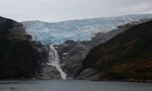 Patagonia: today we will go over a brief geography lesson and history lesson about the Strait of Magellan , Patagonia, Tierra del Fuego and the Chilean Fjords Passing through the narrow Glacier Avenue in Ushuaia. Here there are five ice streams that...